Watermarks Project: live in Bristol 2009
Sea levels are rising due to climate change… but how much could they rise and how quickly? And how could this affect the city of Bristol?
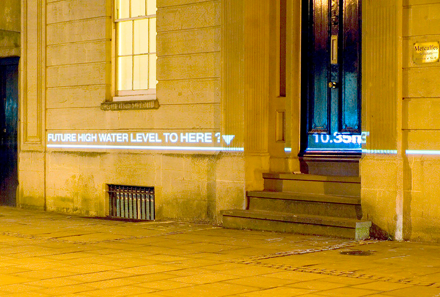
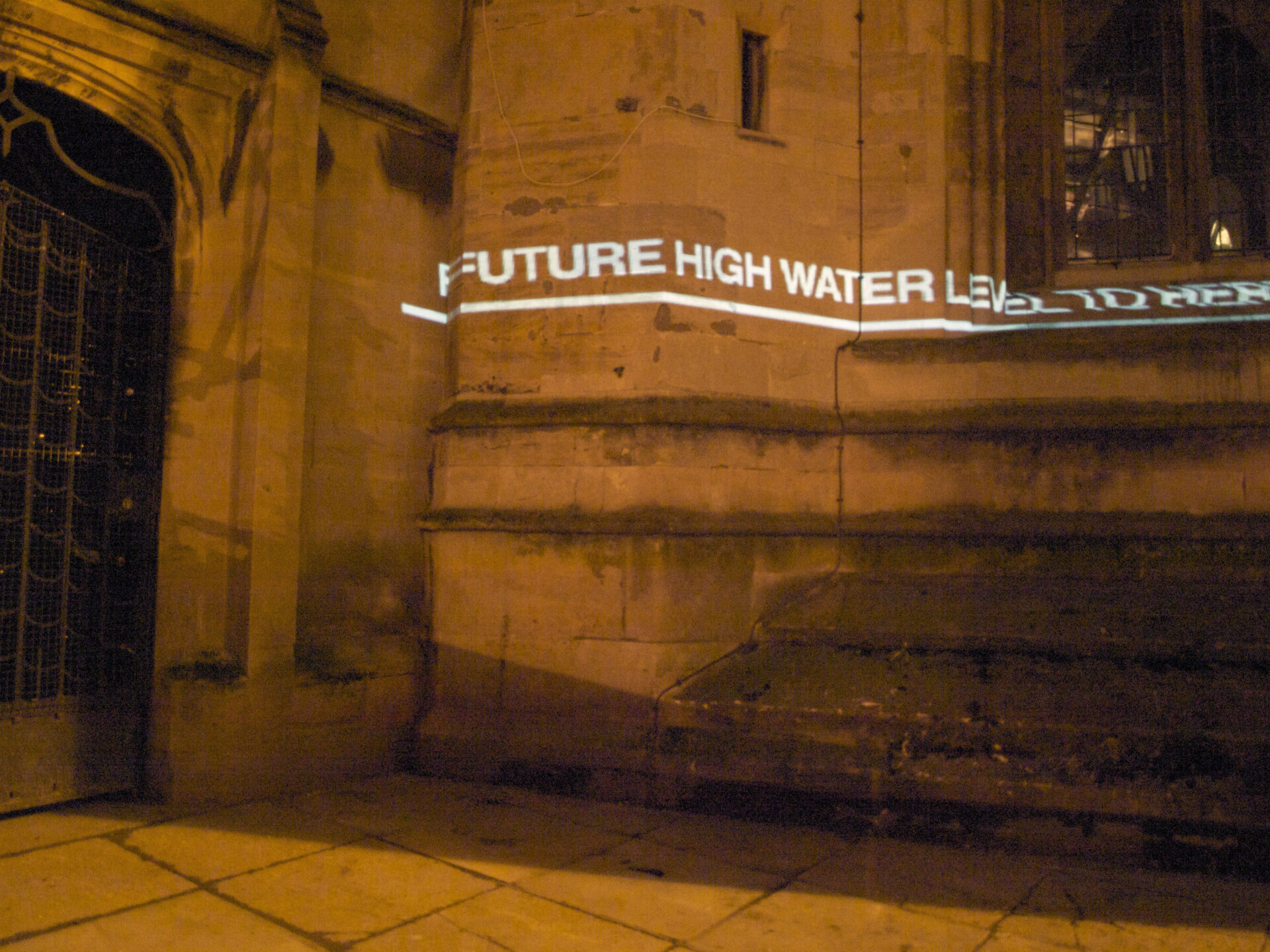
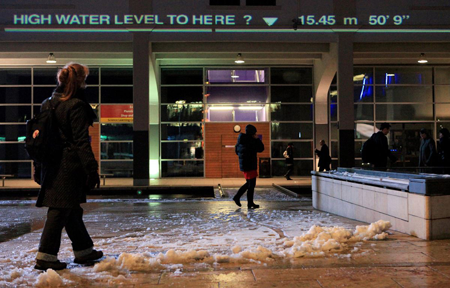
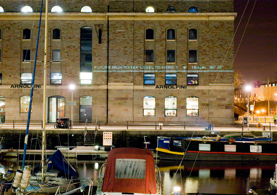
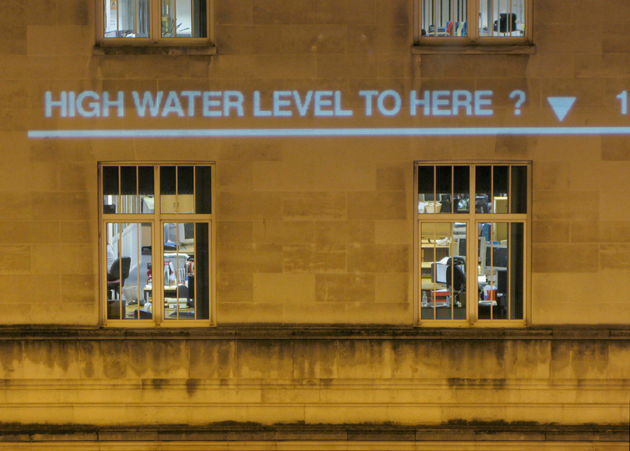
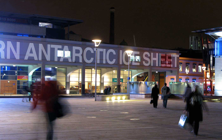
Watermarks was a public art project by Chris Bodle that explored these questions. Between 6th and 12th February 2009 a series of large-scale projections were displayed at sites across the centre of Bristol. Flood level marks were projected on to the facades of buildings, showing how high water levels could potentially rise if the sea were to inundate the city. By displaying these levels in real space, the project aimed to help the audience imagine the depth and extent of this potential future flooding – allowing us to measure the possible future water levels against ourselves in familiar environments. The Bristol projections, funded by Arts Council, England, were the first phase of Watermarks – further phases will extend the project elsewhere in the UK and abroad.
The complexity and inherent uncertainty involved in predicting sea level rise means there is little consensus across the global scientific community as to how much sea levels could rise in the coming decades. The Watermarks project used UK government predictions, available at that time, for the next century to set the key flood mark levels.
The project, however, also explores other more extreme, hypothetical scenarios such as the melting of the Greenland Ice Cap. Future phases of the project will use the latest sea level prediction data as it emerges – displaying a wide range of potential scenarios from across the scientific community. This project aims to act as a provocation and catalyst for debate.
The future of our cities and landscapes and our responses to rising sea levels should not just left to scientists, politicians, engineers and the built environment professions, but emerge from as wide a base as possible with participation and involvement from all sections of the wider community. Ultimately the mitigation and adaptation measures will be social and cultural as much as scientific and technical.